Hello All,
Just popping on as I found an interesting series of photos in between the subject I finished on last time and that I was going start on next time…my trip to Germany a while back. Now, I’ll say in the very early stages, this may or may not interest you so I won’t take offence if I don’t get any feedback! However, I find this kind of thing very interesting and, in a way, beautiful when it comes to the shapes in the clouds. If it is one thing I’d encourage you all to do, it is to look up once in a while, clouds aren’t all flat and grey.
One afternoon, just wandering around the house minding my own business I expect, the day got a little heavy cloud-wise and the first clue that something was swirling around appeared…
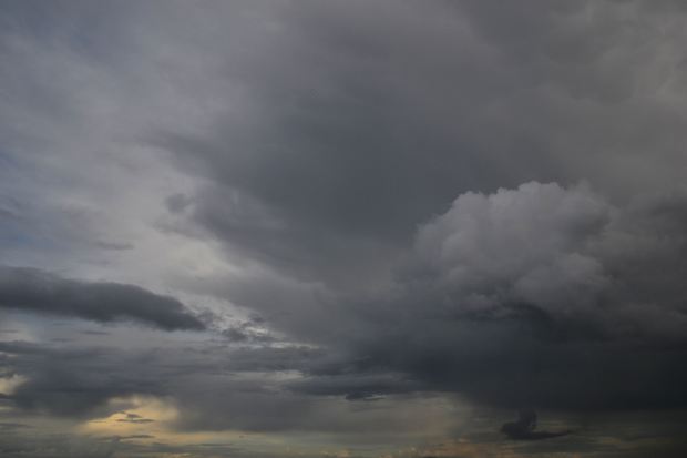
Now, without being able to point in directions and add annotations (I haven’t worked that out yet) you can see that a shelf of cloud is developing and is moving in from the upper part of the sky from right to left. In the distance, you can see the yellow colour displayed when there is rain in the air too and even a bit of virga. The thing is, when you looked to the left, the same was happening….

In this image, you can see in the upper part and the lower part there is some compact and elongated mammatus and some distinct curves in the cloud where more is developing. A sure sign that rain is coming! However, seeing one big lump is coming one way and one the other, this is where is got interesting as they met in the middle and created this kind of melee of tumbling clouds at low-level…
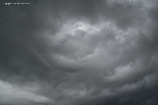
This continued on for quite a while and things got very dark and distinct lines of where the air is pulled in and pushed out became apparent in the form of asperatus-like curves and shapes…

Sadly, all things come to an end and the lovely show came to messy finish where everything was jumbled up all over. I was hoping for a rain shower, a clap of thunder or maybe I read things entirely wrong!

Mind you, not being one to give up easily when it comes to clouds (I often wonder what the residents of the houses backing on to the fields where I take my sunset pictures think of me) I saw that following this was a very distinctly shaped cloud which I have looked around for on the webby net. It seems that it ticks all the boxes for part of a flanking line for a storm cloud, so I think I was right! It was a storm close by but not over us..
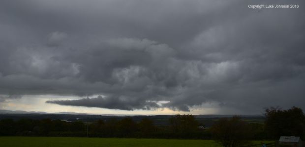
In the words or Mr Wikipedia “a flanking line is an area of small clouds that mark an area of widespread updrafts in front of strong thunderstorms. These flanking lines generally occur in the vicinity of supercells or large multicell thunderstorms. The bases of the clouds making the flanking line are merged (like in the picture). The forefront area usually has no rain” (this accounts for the fact there was no rain the whole time.
“These feeder clouds will merge with the main cumulonimbus and will regenerate the storm.” That I can’t vouch for but “the feeder clouds are located at the west or southwest of the main cloud” I can vouch for as the large town that pretty much always has these big rain storms is located in that direction.
Just call me John Kettley.
Well, this concludes an overly scientific and speculative diagnosis of weather in my area of Wales. Next time, we embark upon a road trip to Germany! Thanks for dropping by and sticking with me in this post.

#1 by Nat Carter Artography on December 16, 2016 - 3:43 am
Very dramatic.